

Cedar Fort, UT 84013Cedar Fort, UT 84013
Utah County
Description
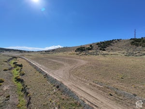
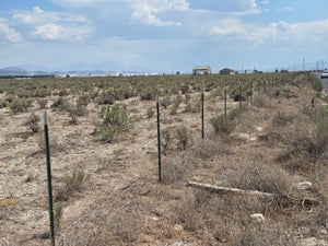
This lot is 20 acres of freedom with amazing views of the Oquirrh Mountains and the more secluded side of the Cedar Valley. This lot is zoned RA-5 meaning that it is considered both agricultural and residential and can be subdivided into 5 acres parcels. Adjacent to homes with power, water, and septic sewer, the proximity typically simplifies the process of extending utilities to a new residence. The lot does not come with any water, please call with any questions or feel free to drive by and see all the potential of this gorgeous rural 20 acre property!
Property Information
- Property type
- Land
- Lot size
- 20.61 acres
- Lot dimensions
- 0.1x0.5x0.1
- Zoning
- Single-Family, Agricultur
- Days on market
- 158
- MLS® Listing#
- 2154646
Property Features
- Cooling
- None
- Heating
- None
- Fencing
- Partial
- Lot features
- Level
- Utilities
- Sewer Not Available
- Sewer
- None
Schools
- Elementary
- Cedar Valley
- Middle
- Frontier
- High
- Cedar Valley High school
Financial Details
- HOA
- None
- Annual taxes
- $5,096
- Parcel number
- 58-049-0008
Directions
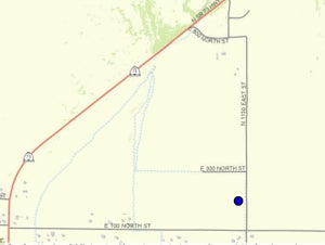
Maps will get you closest to the parcel if you put in 2055 N 1300 E, Cedar Fort, UT 84013 in google maps It is the neighboring property to the north. SW corner is the first corner you will come to on N 1760 W The coordinates to the corners of the parcels are as follows. SE Corner: 40.358664 -112.078613 NE Corner: 40.359600 -112.078760 NW Corner: 40.359691 -112.088292 SW Corner: 40.358753 -112.088264

Listing Courtesy: ERA Brokers Consolidated (Salt Lake) - 8013410901
Last Updated: 2026-04-29T00:00:00.000Z