MLS® Listing#2025018174 · Land · Listed Sep 19, 2025
6600 Dyer Rd, Baker, LA 70714
Rural Tract (no Subd) · East Baton Rouge County
Showing 5 of 5 photos
28Acre lot
Description
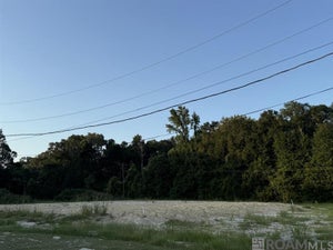
Land Size: 27.68 Acres (510x2158) 1,100,580 sf Flood Zone: AE Frontage: 510 There is a pipeline cutting it in half 2016 Flood: Yes Opprotunity zone: No It does not look like it is in wetlands R Rural (EBR) The purpose of the Rural district is to permit Agricultural and Low-Density Residential development. If an area is designated Agriculture/Rural on the Comprehensive Land Use and Development Plan “Comprehensive Land Use Plan” and is zoned Rural, all lots in a development shall be a minimum of one acre. If the area is designated as any other use on the Future Land Use Map, the maximum density allowed shall be 7.3 units per acre until March 30, 2018, after which date the maximum density shall be 4.1 units per acre. In addition, churches, schools, public buildings, recreational facilities, and accessory uses normally compatible with surrounding low-density residential development may be permitted.
Full description online — scan the code for the complete listing.
Property information
Property type
Land
Lot size
28 acres
Days on market
383
Features
Lot
Level
6600 Dyer RdBaker, LA 70714
Rural Tract (no Subd) · East Baton Rouge County
$300,000List price
27.68Acre lot
12 months agoOn market
Description
Land Size: 27.68 Acres (510x2158) 1,100,580 sf Flood Zone: AE Frontage: 510 There is a pipeline cutting it in half 2016 Flood: Yes Opprotunity zone: No It does not look like it is in wetlands R Rural (EBR) The purpose of the Rural district is to permit Agricultural and Low-Density Residential development. If an area is designated Agriculture/Rural on the Comprehensive Land Use and Development Plan “Comprehensive Land Use Plan” and is zoned Rural, all lots in a development shall be a minimum of one acre. If the area is designated as any other use on the Future Land Use Map, the maximum density allowed shall be 7.3 units per acre until March 30, 2018, after which date the maximum density shall be 4.1 units per acre. In addition, churches, schools, public buildings, recreational facilities, and accessory uses normally compatible with surrounding low-density residential development may be permitted.
Property Information
Property type
Land
Lot size
27.68 acres
Lot dimensions
510 x 2,100
Days on market
383
MLS® Listing#
2025018174
Property Features
Lot features
Level
Water source
Other
Directions
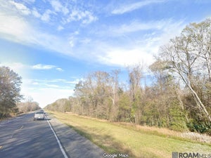
North on Plank Rd, turn right on Dyer Road. You will pass the power plant on the right. The property will be right after the electrical lines right of way.
Listing Courtesy: Castro Real Estate Services, LLC - 2259367643